Showing posts with label from uptown: 30-60 minutes. Show all posts

Tuesday, June 21, 2022

Mountain Creek Park

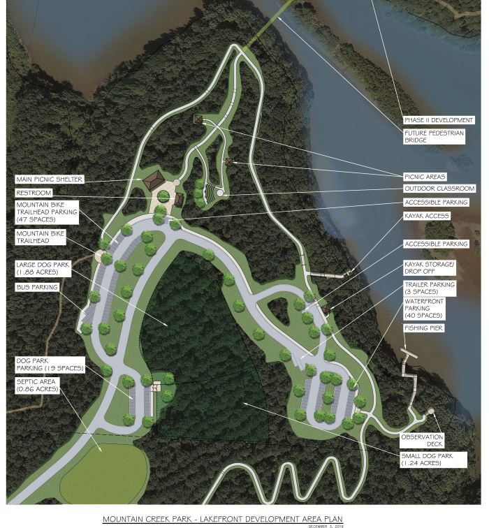
This past weekend, the Charlotte area's coolest new park opened to well-deserved fanfare. Mountain Creek Park, located at the northern tip of Lake Norman in Sherrills Ford, about 45 minutes from uptown, is 606 acres of recreation bliss. It checks all the boxes for family-friendly outdoor adventure fun. 

Parents with young children will appreciate the large, shiny, new playground and paved walking paths for strollers, scooters, skates and beginner bike riders. 

Sports enthusiasts will enjoy the pickleball courts, canoe and kayak launch and hiking trails. 

Pet lovers will be thrilled with the spacious dog park and shady walking paths. 

Fisher-people will like the fishing pier and waterfront observation platform. 

And mountain bikers rejoice: Mountain Creek Park features an extensive 19.52-mile network of trails, dedicated bike-only trails with countless route options, a pump track, a skills course and tool stations. (Here's a trail map.) 

There are also restrooms, plenty of parking, picnic shelters, an outdoor classroom, and a paved ADA-accessible trail that meanders through a quiet cove. 

Best of all, this Catawba County park is free and open to the public from 7 a.m. to 8 p.m. daily. 

Miss the grand-opening celebration? No worries. The party's just getting started. Mountain Creek Park will remain a worthy destination for years to come. Next time you're looking for a new place to play and explore, keep this recreation retreat in mind. 

How to get there
: 
Mountain Creek Park is located at 6554 Little Mountain Rd., Sherrills Ford, NC 28673. 


Friday, June 17, 2022

Historic Brattonsville

There's lots to do and see at Historic Brattonsville, located in Rock Hill, SC, about 45 minutes from uptown. But this Juneteenth weekend, let me direct your attention to a new exhibit: "Liberty & Resistance: Reconstruction and the African-American Community at Brattonsville, 1865-1877."

This exhibition tells a powerful story of four "freedom seekers," who fled Bratton Plantation in search of freedom. If follows their journeys from escape, to military service in the Civil War, to civil rights advocacy to, in some cases, lynching. It's at once heartbreaking and inspiring, tragic and extraordinary, hard to reconcile and vitally important to acknowledge and understand. 

Brattonsville has long sought to tell the stories of the enslaved people who lived, worked and died there. But this exhibit, now part of the federal Network to Freedom program administered by the National Park Service, embraces a different perspective on the lives of some of those who courageously sought freedom and valiantly fought for civil rights. It is located in the newly restored Brick House. 

Historic Brattonsville features more than 30 historic structures and provides visitors the chance to see the evolution of Southern culture from the American Revolutionary War through the American Civil War. It offers an interesting glimpse of local history. Throughout the year, they host a number of events. 

And, if you like to mix education with outdoor recreation like we do, the site boasts a 6-mile network of hiking trails, full of historical significance and ecological diversity. We enjoyed this 3.9-mile loop. Note: The trails are only meant to be accessed with paid admission. 

Historic Brattonsville is open Tuesday through Saturday from 10 a.m. to 5 p.m. and Sunday from 1 p.m. to 5 p.m. It's closed on Monday. Admission is $8 for adults, $7 for seniors, $5 for youth ages 4-17, and free for kids 3 and under. 

Whether you head out there this weekend (there's a Juneteenth celebration on Saturday from 10 a.m. to 4 p.m.) or add it to your list of upcoming outings, go ahead and make time to visit Historic Brattonsville. It's a suitable outing for the whole family and an important chance to understand a significant piece of our shared history. 

Friday, December 31, 2021

South Fork River Park

Happy New Year, y'all. And may we all resolve to appreciate and enjoy nature a little (or a lot!) bit more in 2022. There's so much goodness to be found in the great outdoors. Let us delight in it. 

Whether you're an outdoor enthusiast or just toying with the idea of trying a hike, consider kicking off the new year with an outing to South Fork River Park, located near McAdenville, N.C., about 30 minutes west of Uptown. This 44-acre nature preserve is accessible, peaceful, and a little bit off the beaten path. 

Open daily from 7 a.m. to 9 p.m., South Fork River Park offers a 1.25-mile gravel figure-eight loop trail and 800 feet of river frontage with access points for canoeing, kayaking and fishing. There are also a handful of benches and tables for a picnic along the banks. 

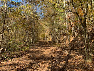
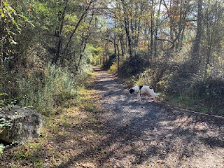
The trail is wide and flat, largely free of roots and rocks, making it good for a leisurely stroll, brisk hike or quick jog. It's worth noting that there are some steep stretches as the path winds its way down to the river and back up again, but the undulations are a pleasant challenge on an otherwise tranquil excursion. 

I couldn't find a map online, but there is one posted at the trailhead. You'll see that the river stretch is along the northern loop of the trail. The most direct route to the water is to veer right/straight at the first split from the trailhead, but going either direction will get you there from the parking lot. 

When we went, we took snacks and enjoyed a break on the riverbank, watching wildlife and listening to the river tumble over the rocky shoals. We had the place to ourselves, and I wouldn't be surprised if it's often similarly unpopulated. Next time, we'll take fishing gear and stay a while longer. 

There's a spacious paved parking lot at the park entrance, but no restroom facilities, so plan accordingly. 

South Fork River Park offers a simple, but pleasant option for an active outdoor adventure to kick off the new year on a positive foot. Go ahead and make this the first of many opportunities to delight in nature in 2022. 

FYI, South Fork River Park is different than the South Fork Rail Trail and the nearby South Fork Trail, both of which are also good recreation options.  

How to get there: 
South Fork River Park is located at 4185 Mountain View Street, Gastonia, N.C., 28056. 

Thursday, December 9, 2021

South Fork Rail Trail

A friend recently invited me to take a hike along the South Fork Rail Trail, located in Lincolnton, N.C., about 45 minutes northwest of uptown, and I'm so glad she did. This trail, a segment of the Carolina Thread Trail, is a beautiful place for a stroll through the woods. It also offers an opportunity to learn a little bit about local history. 

The South Fork Rail Trail, a 1.8-mile (one way) natural surface and crushed gravel trail, is situated in the 324-acre Rhyne Preserve, a tract of land protected by the Catawba Lands Conservancy. It runs along the South Fork of the Catawba River and is relatively flat, making it an excellent option for an easy hike or beginner mountain-biking outing. There's one street crossing where Southfork Rd. bridges the river, but the trail is otherwise protected and traffic-free. 

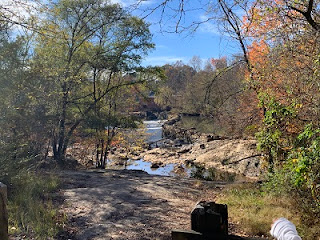
This is a beautiful area, featuring views of the river and rock outcrops, a bald cypress swamp, a shady mature forest canopy, and lots of wildlife. (South Fork Rail Trail is a part of the North Carolina Wildlife Federation Butterfly Highway.)

Another point of interest is the historic Laboratory Mill, located just across the river from the trail. You can see it about a quarter-mile into your hike. (You'll also pass it on your drive to the trailhead parking lot.)

Known as the Lincolnton Cotton Factory from 1819 to 1863, in addition to processing cotton, this water-powered mill once served as a laboratory established by the Confederate States of America to manufacture drugs from indigenous plants. There is some speculation it may also have been used for the production of gunpowder. You can read more about the mill's history here. The preserved building is now an event venue. 

The South Fork Rail Trail is open dusk 'til dawn daily. At the gravel trailhead parking lot, you'll find plenty of parking and a trail map kiosk, but no restroom facilities. 

If you're looking for new territory to explore, grab a friend and check it out. I think you'll be glad you did.  

Note: The South Fork Rail Trail is different from another of our favorites, the South Fork Trail. Similar names, both situated along the same river about 20 miles apart, and each excellent options for outdoor exploration. 

How to get there: 
The South Fork Rail Trail trailhead parking lot is located at 2677 Laboratory Rd., Lincolnton, NC, 28092. 

Friday, November 19, 2021

Kings Mountain Gateway Trail

What a glorious fall it has been! For weeks now, every time we leave the house, I can't help but declare "look at those leaves!" Have you noticed, too? The colors are brilliant. The autumn hue is golden. Magical, right? It's the perfect backdrop against which to explore.  

Here's a trail you might consider for your next outing. (This one might be good for entertaining family in town for the holidays!)

Check out Kings Mountain Gateway Trail, located about 45 minutes west of Uptown, just past Gastonia. This Carolina Thread Trail segment offers hikers and bikers eight beautiful miles of trails. 

The trail system begins in a gravel lot, which features restroom facilities, a picnic shelter with grills, and a map kiosk.

Just behind the picnic shelter is a short interpretive nature trail for children. From the main trailhead, you have four options, all of which begin along the Rail Trail Loop, a 0.7-mile gravel path built along an old rail bed. 

From the Rail Trail Loop, you can jump on the Plateau Loop (0.8-miles long), a moderate paved incline; Cardio Hill (0.4 miles, one way), a strenuous gravel trail that ends with an overlook of the city and surrounding areas; or the Foote Trail, a rolling gravel trail that ranges from flat to strenuous over 4.5 miles (one way).  Here's a trail map. 

We enjoyed a stretch of the Foote Trail, which winds its way by an abandoned quarry, through fields and forested areas, and over creeks. We hiked, but would consider taking bikes next time. Both are good options for this destination (though there are some hilly sections on which a beginner mountain biker might need to dismount and push). 

Along the trail, you'll find benches to take a snack break. Of course, a nice thing about such a long out-and-back is that you can go as far or as short as you're up for. 

The Gateway Trail is open dawn to dusk daily. You can check out scheduled events here. 

Another fun fact: Kings Mountain Gateway Trail is minutes from Hounds Drive-In Theater (the trail runs directly behind a couple of the screens!). It's also about a half mile south of downtown Kings Mountain. Either/both might make for a nice combo outing if you're looking to entertain for the day.  

One day, this portion of the Carolina Thread Trail will connect the City of Kings Mountain, Crowders Mountain State Park, Kings Mountain State Park and Kings Mountain National Military Park. For now, it's a nice standalone option for a hike or a ride. 

How to get there: 
The Kings Mountain Gateway Trailhead parking lot is located at 807 S. Battleground Ave., Kings Mountain, NC, 28086. 

Friday, September 10, 2021

Andrew Jackson State Park

On our way to check out the Lindsay Pettus Greenway in Lancaster, SC, over the summer, we decided to tack on a visit to Andrew Jackson State Park. I'm glad we did. As far as State Parks go, this one feels bite-sized, yet satisfying. 

Andrew Jackson State Park, which is located a little under an hour south of Uptown, is relatively small, but is beautiful and full of history and educational and recreational options. 

Home to the birthplace of the seventh president of the United States, this park has a museum of Revolutionary War artifacts, an 18-acre lake for boating and fishing, two one-mile hiking trails (one of which is a Carolina Thread Trail), and 25 campsites.
 
The park often hosts living history programs and the museum offers interactive exhibits. (Check out the calendar of events.) One of our favorite stops was at the 18th century replica schoolhouse. We also enjoyed running around the large, open field at the main entrance. Nearby is an amphitheater and Meeting House for community events.
 
Andrew Jackson State Park is a lovely destination for a short, quick hike with some educational opportunities sprinkled in. Here's a park map.

You might consider pairing it with a visit to Lindsay Pettus, like we did. It's a short, 15 drive between the two. Ride the greenway, then enjoy a quiet picnic under the shade of the old-growth forest at the state park. 

Andrew Jackson State Park is open 8:00 a.m. to 6:00 p.m. daily from November 1 through March 31, and 9:00 a.m. to 9:00 p.m. daily from April 1 through October 31. The Museum is open Saturdays and Sundays from 1 p.m. to 5 p.m. and Monday-Friday by appointment. 

Admission is $3/adult, $1.50/senior, $1/children 6-15, and free for children 5 and younger. 

Andrew Jackson State Park makes for a simple, but enjoyable nearby outing, and something different worth checking out, especially if you haven't been before.  

How to get there:
Andrew Jackson State Park is located at 196 Andrew Jackson Park Rd, Lancaster, SC 29720. You'll pay for admission ($3/adult, $1.50/senior, $1/children 6-15, and free for children 5 and younger) at a kiosk on your way in. 

Wednesday, July 14, 2021

Lake Corriher Wilderness Park

On the way to see the Eccentric Cycles Exhibit at the N.C. Transportation Museum in Spencer, N.C. (fascinating and worth a visit!), we decided to check out a new-to-us park and trail. Which is how we discovered Lake Corriher Wilderness Park, located in China Grove, NC, about 40 minutes northeast of uptown Charlotte.

Lake Corriher Wilderness Park, located in the Lake Corriher Wilderness Area and run by the Town of Landis Department of Parks, is home to Lake Corriher and the old town reservoir. The park offers fishing (by permit), camping (by reservation), boating, disc golf (a nice, 12-hole course) and, of course, hiking. The park office provides passes and gear rentals (kayaks, discs, etc.) and is open 8 a.m. to 8 p.m. April through September and 8 a.m. to 5 p.m. October through March.

We found Lake Corriher easy to get to, full of wildlife, and pleasant for a water-side stroll. From the parking lot, you're a stone's throw from the first of the two lakes. There's also a map kiosk near the entrance, which is worth a glance before you set off to explore.

We did this hike, which hugs the banks of both lakes, following the red blazes on the first stretch and blue on the back half. A third of a mile in, there's a large picnic area with fire pits and large rocks for climbing on. While the start of this hike is pretty flat and easy, there's a reason for the "rough terrain" warning sign father in. Lots of rocks and roots make for a more challenging excursion. It's navigable, though, and one of our favorite parts was the boardwalk bridge crossing the tip of the second lake.

Another shorter, simpler hike is this Carolina Thread Trail around the first lake. It's less than a mile and good for all ages and abilities.

A word of warning: There's a spaghetti network of well-worn spur trails that are not all well marked. This makes it easy to get off track if you're not paying attention. Here's a park map to help you get the lay of the land.

If you're in the China Grove area, Lake Corriher is a nice place to visit. If you're looking for a reason to head up that way, the N.C. Transportation Museum is worth a trip in and of itself (go see the eccentric bikes if you get a chance, but, hurry, it only runs through early September 2021!). Pairing the Lake Corriher hike with a museum tour was a lovely day-outing for our crew and I'd recommend it to you as well.

How to get there:
Parking for Lake Corriher Wilderness Area is located at 955 Kimball Road, China Grove, NC 28023.

Thursday, April 1, 2021

Morrow Mountain State Park: Short Bridle Loop

A new-to-Charlotte friend asked me for ideas for a nearby hike she could take with her husband on her birthday. Something with a view. A little bit of a challenge, covering at least several miles. Dog-friendly.

Fortunately, we'd just done taken a hike that checked all the boxes. If you're looking for a trail along the same lines, here's what I would recommend.

Morrow Mountain State Park is about an hour east of Charlotte, just past Albemarle. There are around a dozen trails and lots of other fun things to do at Morrow Mountain. Though the park is east of town, it encompasses four mountains, the tallest of which has some elevation (936 feet) and offers a pretty impressive 360-degree view of the surrounding area.

To take an invigorating 5-mile hike, beginning and ending with a view and traversing some gorgeous land in between, I recommend a combination of segments of the Morrow Mountain Trail and Bridle Trail. Here's a park map. 

To do this hike, park in the Morrow Mountain picnic area parking lot (take a right at the intersection where the main entrance road splits). This puts you at the pinnacle of the the mountain to start. Here, you'll find scenic overlooks, a picnic shelter, and some informational signs about the area's historical significance. 

Take the Morrow Mountain Trail (blue triangle blazes; look for the trailhead just over the stone wall by the parking spaces at the front end of the parking lot) a little over half-mile downhill. (Note: This section is steep and strenuous.)

When Morrow Mountain Trail intersects with the Bride Trail: Short Loop (white circle blazes), take a left or right to hop on a pleasant, rolling, 3.9-mile loop. This section of trail is wide and quiet. As the name suggests, you might encounter horseback riders (and almost certainly need to watch for equine droppings). This seems to be one of the less popular (read: "less crowded") trails in the park, which makes it dog-friendly and perfect for a little solitude.

When you complete the Bridle Loop, retrace your steps up the Morrow Mountain Trail and plan to catch your breath -- and maybe have a picnic lunch or snack -- perched along the stone wall overlooks.

We loved this hike -- and so did my birthday-celebrating friend -- but if it's been a while since you've hit the trails, you might consider some other options at Morrow Mountain State Park first. Here are a few we've enjoyed: 
Happy trails! 

How to get there: 
Morrow Mountain State Park is located at 49104 Morrow Mountain Rd., Albemarle, NC, 28001. To do this hike, park in the Morrow Mountain picnic area parking lot (take a right at the intersection where the main entrance road splits). The Morrow Mountain Trail trailhead is just over the stone wall by the parking spaces at the front end of the parking lot. 

Thursday, March 18, 2021

Riverbend Farm Trail

Years ago, we discovered Riverbend Farm for it's pumpkin patch and epic playground (Check it out: Our Favorite Pumpkin Patch). At the time, I noticed a Carolina Thread Trail sign by the farm and made a mental note to return to explore. Recently, we did and loved it.

Riverbend Farm Trail is an easy, 0.8-mile (one way) natural surface trail, good for all ages and skill levels, that circles the perimeter of the farm. A short distance from the trailhead is a canoe/kayak put-in.

To get to the trail, follow the gravel road to the right of the farm entrance. This will end at a gravel lot. The trailhead is marked with a sign. From the lot and the through first section of the trail, you'll be able to see farm animals grazing.

The trail, which follows the Rocky River, is quiet, peaceful and full of wildlife. We saw deer and racoon prints, heard frogs chirping and saw a number of birds. The trail ends on the far side of the farm at a large sandy area (insider tip: this is a great place to let kids play a while; pack a sand shovel if you think of it!). This section is downright bucolic.

Bonus, Riverbend Farm is a stone's throw from the Sundae Shop, a most excellent stop after a day on the trail. Everything you could ask for in a super relaxed, pleasant, family-friendly outing. 

Note: There are no restroom facilities at the trail; plan accordingly.

How to get there:
The Riverbend Farm Trail trailhead is near, but not at, Riverbend Farm, located at 12150 McManus Rd, Midland, NC 28107. Take the gravel road to the right of the farm entrance. This will end at a gravel lot. The trailhead is marked with a sign. Here's a map to the trailhead parking lot. 

Don't forget to pack:
  • Comfortable walking shoes
  • Hats, sunglasses and sunscreen
  • Water and snacks
  • Sand toys